Pages


Saturday, May 28, 2011

Lake Argyle

24 May
After saying farewell to Edith Falls and the enjoyable time we spent there we made tracks for Lake Argyle - the largest man made lake in the Southern Hemisphere. We stopped at Victoria River for lunch (a town that consists entirely of a roadhouse with a motel attached) and continued on to Durack Homestead - the original stone house that was owned by Durack family that owned much of the land that was flooded when the Ord River was dammed to form Lake Argyle. Declan said it looked like new as they had recently painted inside.
Durack Homestead
The house was pulled apart stone by stone, numbered and put into 44 gallon drums, then transported to its current location. The family waited for some time before funding came through to turn it into a museum by which time the numbers had washed off the stones. The house was then rebuilt using the same stone in an order as near as possible to the existing house. The house contains much information about the way the family lived and some of the equipment and tools they used.


Lake Argyle from caravan park swimming pool
Our campsite for the night was the Lake Argyle caravan park which has an amazing  view from their wet edge swimming pool (which was so cold even Declan didn't go for a swim). The lake itself has had a remarkable effect on the wildlife with some of the animals on the endangered list being struck off since the lake was built (it also provides hydro-electricity).
Tim and Declan rose early the next morning to go fishing as we were still on NT time. So they were up at 5.30 and Tom and I got to sleep in (till 6.00!) Turns out we were a little early packing the sleeping bags away, being a bit further south it was cold at night (about 12 degrees).
Once again Tom and I packed the tent and waited for the fishermen to return. A nice gentleman suggested I should be rewarded for packing by being bought a diamond in Kununurra, Tim didn't agree.  I don't know why, pink diamonds were only start at $10,000!

The Bungle Bungles

25 May
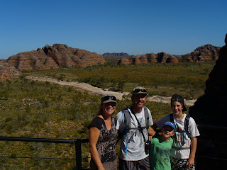
Declan and I (Tim) woke up early to go fishing and (surprise surprise) we didn't catch anything before we returned to camp to find Linda and Tom well under way with packing up. Once finished we were on the road making tracks for the Purnululu National Park which contains the Bungle Bungles. After stocking up in Kununurra on the way (and Linda browsing the diamonds from a shop that are sourced from the local Argyle Diamond Mine) we made good time to the turnoff to our campsite for the night. From there the GPS told us that we only had 59km to go. After seeing a sign that told us to let our tyre pressure down to protect them we knew it was going to be a slow trip in. With quite a few creek crossings, mud, rocks and plenty of corrugations we finally finished the final 59km in two and a half hours – just as the sun was setting. This was not the best time to arrive at bush camping. Every site was taken and we had to squeeze between two groups (we weren't about to trek out and find somewhere else to camp). It didn't help when the boys started fighting and we were given long looks by our neighbours. After fights were settled we have become very routine and everyone knows what needs to be done to set up. This meant we we sitting down to a lovely dinner of butterflied lamb and veg with the hour. A great meal finished with a glass of port in a fantastic setting!

26 May 
We had planned to have a big day of hiking this morning but found out that a couple of the walks in the north of the park were still not open because of the amount of water still in the area.
While checking the health of our car batteries I discovered the remnants of our air conditioning belt and so spent the next hour under the bonnet replacing it with a spare that we had bought with us. Turns out our neighbours were very friendly people and even came over and gave us a hand. One of them was a pilot and had been flying tours through the area for years and had much information to share.
Finally underway we headed off to the Visitors Centre and then on to Kungkalahayi Lookout in the northern section of the park. The 360 degree views to the 500 million year old orange limestone cliff faces of the western escarpment of the Bungle Bungle Range were lovely but we were really interested in seeing the Bungle Bungles up close.
Kungkalahayi Lookout
After a 30 minute drive we were confronted with an amazing view from the carpark but the best was yet to come. We decided to do three walks in one hike which took around two and a half hours. The three walks were: The Dome Walk, Cathedral Gorge, and Piccaninny Creek Lookout.
The Dome Walk - Bungle Bungles
The Dome Walk took us past and around beautiful sandstone domes that rise out of the surrounding plains. It was only a short walk but whet our appetite for the sites to come.


The Cathedral Gorge Walk has now taken over from Kings Canyon as my favourite attraction on this trip. The whole walk is amazing with postcard-like scenery everywhere but finishes with a breath-taking amphitheatre that has to be seen to be believed. The colour and size of the gorge is fantastic and both Thomas and Declan loved the acoustics.
Cathedral Gorge Amphitheatre - Bungle Bungles
Cathedral Gorge - Bungle Bungles

Piccaninny Creek Lookout
We stayed in Cathedral Gorge for quite some time just taking in the serenity (punctuated regularly by the boys testing the acoustics and the shutter on my camera working overtime, Linda was speechless) before trecking out to the Piccaninny Creek Lookout. This is the longest of the walks with once again picturesque scenery everywhere. On arrival at the lookout the views over Picaninny Creek were amazing and I find myself running out of descriptive words for this beautiful area. 
Unfortunately the northern area of the park was closed due to flooding. So much water it has apparently destroyed much of the area and they are considering pumping the water out. It is not expected to be open till September or October - even then it will be the beginning of the next wet.
Piccaninny Creek Lookout


Kakadu National Park (cont.) and Edith Falls

22 May
Gunlom
Today we left Kakadu National Park but decided after hearing that Gunlom had just been opened we should visit. It is toward the south end of the park and the direction in which we were leaving the park.
Turning off the road we encountered quite a rough unsealed road and with the camper trailer in tow it took us quite a while to travel the 39km. Upon reaching our destination we found a beautiful waterfall cascading into quite a large billabong. We had already decided not to swim due to crocodile danger but found someone already in the water. Still, we all decided he must be crazy!
The Rockhole

Speaking to another camper in recent days he suggested we go to The Rockhole, only about 5km south of the Gunlom turnoff (although not signposted). The unsealed road was quite bumpy and the first time we have needed to engage 4WD in low gear.  The Rockhole is stunning, and because it is not signposted, we were the only ones there.  This made us very nervous about swimming and tempting as it was we chose to continue our journey to Edith Falls. This rockhole was probably my favourite spot in Kakadu. 
Edith Falls
Edith Falls is located in the northern end of Nitmiluk National Park and has a small campground with good facilities including hot showers and a small kiosk. We set up  camp and decided to walk out to the falls (1.2km) the next morning. We filled time playing bocce and cards as the sunset. It has been so warm at night the kids have packed their sleeping bags away and are just using their light rugs.

23 May
When we arrived we found a beautiful swimming hole that was very popular. We spent a couple of hours swimming in the currents, climbing over rocks and exploring the waterfalls. It was a very relaxing morning and very enjoyable. While the boys climbed waterfalls I relaxed with a book which ended up in the water and has now spent the week drying on the dashboard! The lower swimming hole which is next to the camp site was closed until they were sure there were no crocodiles. This is quite a large billabong which would make a beautiful spot to swim but better safe than sorry.
Edith Falls - Lower Pool


On returning to our campsite we played bocce and threw the frisbee. The rangers came by and told Thomas and Declan they could run under a sprinkler for as long as they like. No water restrictions up here! .

Friday, May 27, 2011

Kakadu National Park (cont.)

20 May
Rock Art at Nourlangie Rock
Today we experienced Nourlangie Rock, an area rich in aboriginal rock art. We decided with the weather being so hot that we should do all our hiking early and head back to the pool in the afternoon. There was a couple of ranger talks in the morning at different sites so we planned our walking around these. The first stop was Arnbangbang Gallery where one of the rangers talked to us about an aboriginal story painted on the rock. This picture was only painted in the 1960's by one of the last remaining members of the tribe that inhabited this area in an effort to pass down the stories. The tribe has since died out but the stories are being told by neighbouring tribes.
 Views to Arnem Land from Gunwardewarde Lookout
From here we walked up to Gunwardewarde Lookout and saw the area in Arnhem Land where Narmeggon the Lightning God (the small white figure in the top right of the painting with things that look like antennae coming from his head) lives.
After visiting the Arnbangbang Shelter and hearing a ranger talk about tools and implements the local aborigines used, we drove to Mirrey Lookout for a 360 degree view that overlooked the plains and all the way to Arnhem Land.

Nourlangie Rock from Mirrey Lookout
With the heat beginning to take its toll on the boys, we headed back to our campsite to have lunch and then spend a relaxing afternoon in the pool.

21 may

After arriving at the Kakadu Resort and starting to set up the camper trailer I discovered the back end of the car was unusually low and had to jack the trailer up to unhitch it from the car. After a call to the RACV and a trip in to the Jabiru mechanic it was discovered that our poly airbag suspension had deflated due to the springs pinching them. It seems the person who bought the airbags did not upgrade the springs before installing them.  The end result being we made some phone calls into Darwin and contacted a suspension specialist who was able to fix it for us today. This meant a 6 o’clock start for me to drive in to Darwin to have the car there for an 8:30 appointment. One and a half hours later the job was done, I picked up some supplies and returned the 240km to the resort to find Linda, Thomas and Declan doing homework. Did I get the easy job?

Kakadu National Park (cont.)

19 May
Ubirr Rock Art
We made our way out to Ubirr today to look at an impressive collection of Aboriginal rock art some of which is 5000 years old - it makes the collection of European art seem only very recent. This paint, using ochre rock that is ground into a powder and mixed with a tree resin, has proved to withstand the test of time -  although the aborigines did not paint all their pictures to last such a long time. Some of the pictures were painted to pass down advice to the other aboriginals about local places to find food. At most of the sites paintings have been painted over several times so there is quite a few layers of paintings. Also at this site there is a fantastic lookout along the circular route so as you inspect the art you gradually climb up a very large rock to see a magnificent view of the flood plains below.
The view at Ubirr


That afternoon we had booked an evening cruise on the Yellow Water wetlands which the East Alligator River feeds before it heads out to sea. The wildlife and scenery on show on the evening cruise that we were on was quite spectacular and our cruise guide was extremely knowledgeable. Among many other animals we got to see Saltwater crocodiles; birds such as the Jabiru, Egrets, Eagles, Kites, and Jesus Birds (so named because with their long toes they seem to walk on water). The sunset was amazing as you can see by the picture below. That night the resort was showing a movie and it happened to be Crocodile Dundee - a movie which neither Thomas or Declan had seen before. Both boys really enjoyed the movie and spotted the point in the movie which was filmed at Ubirr.
Sunset on the Yellow Water Cruise


Friday, May 20, 2011

Jumping Crocodiles and Kakadu National Park

18 May
Declan and I (Tim) got up early today and, with a few tips from one of our neighbours in the caravan park, embarked on another fishing expedition to one of the boat ramps near the East Wharf. Unfortunately once again, as with most of our fishing exploits, we returned empty handed but enjoyed the relaxing morning. 
Jumping Crocodiles
We returned to find Linda and Thomas well underway with the pack up and we were quickly on our way to Kakadu National Park. We decided to stop on the way to watch the Jumping Crocodiles where the Arnhem Highway crosses the Adelaide River. We boarded the two-storey boat (Adelaide River Queen) and were pretty soon watching saltwater crocodiles launching themselves out of the water to grab a pork chop off a lure. The crocodile in the picture is one they affectionately refer to as Agro, the biggest crocodile in this part of the river, who is about 6m long and about 40 years old. This picture was taken from the lower deck behind glass but you can also view them from the upper deck out in the open as well. While up there they also through off small pieces of pork where the whistling kites skillfully plucked them out of mid air with their feet, passed them to their mouths while still flying and returned to grab another piece. They are extremely acrobatic and manoeuvre very quickly in the air.
With the cruise finished and both Thomas and Declan complaining about being hungry, we decided to retrace our steps for about 3km to stop and have lunch at Windows on the Wetlands - a very informative and interactive display giving information about the flora and fauna living in the local wetlands.
From there we made the final stretch of the journey in to Kakadu National Park and called into the Bowali Information Centre to buy the obligatory 2 week pass and find out information on which of the sights were open. It seems as though delaying our trip here has worked as more of the sights are now open and the ranger talks have started as well.

Darwin

16 May
As you may well have realised our inital plan of turning off to Kakadu National Park, Darwin and then Litchfield National Park before returning to Katherine has changed due to a few of the attractions in Kakadu being closed due the late rains. We have revised our plans to look at Litchfield, then to Darwin and Kakadu before returning to Katherine. This meant arriving at Kakadu a little bit later and hopefully seeing some extra sights.
On leaving Litchfield National Park we decided to take the unsealed road via Berry Springs to Darwin. This road was fairly corrugated with some deep water ruts that needed to be taken slowly. It is shorter in distance but probably takes a little bit longer to travel. The boys were looking forward to a swim at Berry Springs but were disappointed to find that it too was closed because of the recent rains.
Pushing on to Darwin we found a caravan park in Berrimah, a suburb of Darwin that is fairly close to the city centre, and after setting up camp decided to look around in the city. Darwin has changed quite a bit in the last 5 years or so since I was there and it now boasts a few high rise buildings not just the backpackers hostels and pubs that seemed to line the main street.
Our first point of call was to see the tunnels that were built as an oil storage device during WW2. These tunnels were built to protect Darwins oil storage from air attack during the war but by the time they were finished the war was over and they have never been used for this purpose. There are 2 tunnels open and are now house over 100 wartime photos.
Aquascene
We then headed to Aquascene, a fish feeding business that allows you to feed the wild fish that come in from Darwin harbour every day to be fed by the public. This business has been running for about 50 years and all sorts of fish from Catfish, flathead, mackeral, barramundi and rays can be seen in the same area. They give you bread to feed the fish and provide information about the different species as they appear. Declan and Thomas both enjoyed patting some of the fish as they fed them.


17 May
After a slow start to the morning Declan and I decided to go fishing but by the time we were organised we had struck low tide and had trouble finding a place to fish (due to the 8m tidal variation in Darwin). We managed to find a jetty near a marina and fished for a couple of hours without luck.
As we had been enduring a small water leak in the camper trailer I took the opportunity of being in a large city to find a new piece of hose a repair it. This was not as easy as expected and a few hours later I managed to get the job done while Linda found a supermarket and replenished supplies.
 With most of the day gone we decided to spend the rest of it in the pool just relaxing and enjoying doing nothing.

Tuesday, May 17, 2011

Litchfield National Park

14 May
Wangi Falls
We left Katherine after replenishing supplies and headed for Douglas Springs and had travelled about 35km down a rough road before we came across a road sign telling us Douglas Springs was closed. Upon further advice from the local caravan park we found out that the recent rains coupled with the discovery of a saltwater crocodile  had forced the closure. This may be a place we come to on our return south. Litchfield National Park was the next place we were to visit and being only another couple of hours away we decided to head straight there. Wangi Falls in the park has a camping area and being the only one with hot showers (we were to find out later they were luke warm) and limited sites it fills up reasonably early. As luck would have it we managed to secure a site and, after setting up our camper trailer, went on a hike that circles the falls and takes in some lovely views at it's highest point.

15 May
Thomas and Declan at Tolmer Falls Lookout
Our first stop in discovering Litchfield National Park today was Tolmer Falls. This was only a short walk so we decided to take in Tolmer Creek as well. Tolmer Falls is the more rewarding walk but the creek walk is about 1.2km through some very peaceful woodlands before emerging at the creek and looping back toward the carpark.
The magnetic termite mounds were our next stop. These amazing species of termite only build their mounds facing north-south so that they warm up in the morning before having only the smallest area of the mound facing the sun during the hottest part of the day. This keeps their nest at a very constant temperature.
Buley Rockhole
From there the next three places we went to Tom and Declan had a ball - Buley Rockhole, Florence Falls and The Cascades at Curtain Falls. Buley Rockhole is a series of waterholes of varying depth where you can jump off rocks or just swim in the rapidly flowing water. The boys were very sad to leave after spending over an hour jumping off the rocks.
Florence Falls
Florence Falls has a picnic area and this is where we decided to have lunch before heading down to the plunge pool. Like all the waterholes we have encountered the water was crystal clear and quite cool but refreshing and teeming with fish. Here we were swimming with small Barramundi which were quite inquisitive and would come up and swim between your legs.

The Cascades
The last attraction we visited today was The Cascades. The walk from the carpark to the lower cascades starts off through arid woodlands before turning into a monsoonal rainforest meandering along the river bed and crossing it a few times through the water. We had bought some wetsuit boots in Mataranka and these were priceless in hiking over rocks and gravel paths before walking through the river over slippery rocks. We stopped on numerous occasions to swim and jump off rocks and to swim through the waterfalls to the rock face. The walk back to the carpark took us uphill and back into the arid woodlands which was quite a contrast to the lush rainforest near the river.

Upon leaving The Cascades the boys were quite relieved after a big day that we were not far from camp - only 5 minutes. After cooking once again on the BBQ provided by the National Park Linda showed us how to make damper on a stick over a camp fire . What a fitting end to an action packed day.


Katherine

12 May
Cutta Cutta Caves


Today we headed for Katherine and made a stop at the Cutta Cutta Caves.
 These wonderful caves were carved out of the rock by water reacting with plant material and dissolving with the limestone underneath. This resulted in these caves forming over a very long period. They are now the home to many bats (some of which are only found in these caves), snakes and frogs. They were found in the early 1900's when a graziers cow fell into them. The stalagtites and stalagmites grow at an amazingly slow rate. One that had been broken off during the war when soldiers had taken refuge there was now growing back but was only about 20mm long and 3mm wide.

Katherine Hot Springs
On arriving at Katherine we headed to the Katherine Hot Springs to have lunch and freshen up. The temperature outside was about 30 degrees and even though the water temperature was about 34 degrees it was really refreshing. The swimming area at the springs is quite long with waterfall at the end which Thomas and Declan enjoyed.

From there we sought out the visitor information centre, booked a cruise on Katherine Gorge for the following day and headed out to the Nitmiluk National Park where we set up camp. The National Park camping facility was unlike any we had experienced before. They had powered sites, a swimming pool, hot showers and flushable toilets, a laundry, a kiosk and bar, and even night time entertainment. This was a lot more than most of the caravan parks we have stayed at.

13 May
Katherine Gorge
Today we took the Katherine Gorge Cruise and once again found we had beautiful weather. We took the two gorge cruise which lasted about 2 hours. This means that you cruise up the river in one boat, get out and walk about 300 metres and hop into a second boat. The scenery was stunning and our guide, Rocky, was quite funny and very informative telling us about the formation of the gorge, Aboriginal beliefs and the animals that inhabit the area. There were about 30 species of fish, bats, birds and fresh water crocodiles just to name a few. The salt water crocodiles that are found there are trapped and removed by rangers.
After the cruise we spent a quiet afternoon playing cricket, going for a swim and listening to the live entertainment (much improved on the country and western act we encountered at Mataranka). Ahhh - this is the life!

Monday, May 16, 2011

Devils Marbles and Mataranka

9 May
Today we left Alice Springs and headed for the Devils Marbles. After leaving the School of the Air there was a long drive but as there was nothing in between so seemed the logical choice.  It meant that we could see both a sunrise and sunset at the Devils Marbles. We had heard a lot about the place and it lived up to expectations and, with being blessed with clear skies and just a little bit of cloud,  it added extra colour to the skies.
Sunset at Devils Marbles
Sunrise at Devils Marbles
10 May

After a lovely sunrise at the Devils Marbles we headed towards Daly Waters but as we approached it at about 2:15pm we realised that it was only another 2 hours to reach Mataranka which has beautiful hot springs.  As there was really nothing to see in Daly Waters (except a pub) we decided this was the best option. It meant we could spend 2 nights in Mataranka instead and not have to set the camper trailer up twice.
On arriving at Mataranka we set up camp at the Mataranka Homestead which was very close to the hot springs. Once set up we had a short walk to plunge into 34 degree water that has stone steps and a stainless steel handrail to enter the spring. This, all set under beautiful palm trees, made a very relaxing swim.
Mataranka Springs

That night we were told there was entertainment provided and after dinner we headed up to see an elderly couple playing country and western songs. We decided that we should head back to camp shortly after buying our first drink.


 11 May
Upon waking up the next morning we decided to head out to Bitter Springs. This is another spring naturally heated to 34 degrees. These springs are not regarded as thermal but because the water comes from deep within the ground it is naturally heated by the temperature of the surrounding rocks at that depth. Bitter Springs has a much longer swimmable area than the Mataranka Springs. Thomas and Declan had both brought their inflatable surf mats with them so we all enjoyed floating with the current to a bridge  where we were able to get out and return (quickly because it felt cold out of the water) to the start and float downstream again.

After spending a couple of hours at these springs we hopped out and headed a short distance away to see them feeding Barramundi feeding at Mataranka Manor. This was very informative as they told us a lot of information about the Barramundi and both Thomas and Declan got to feed them. After the talk we decided to have lunch there and we enjoyed freshly cooked Barramundi and chips followed by some fantastic scones, jam and cream. What a meal!
We left Mataranka Manor and headed back to Mataranka Homestead to do a short walk around the springs which we found were closed due the damage from the recent floods (about 6 weeks ago). Oh well. It was a tough decision but we decided to have another swim at the springs. 

Standley Chasm & Alice Springs

7 May
Standley Chasm
The distance we covered in the car today was not very far but very enjoyable nonetheless. We started the day with a trip to Standley Chasm - a feature on private property that has an entry fee. The short walk was well set out leading to a remarkable chasm that would only be about 2m wide at its narrowest. There are a number of other walks in the area but we decided to skip those and move on to the Alice Springs Desert Park.


Thorny Devil
Upon arriving at the Desert Park we were issued with a handset and headphones. There are numbered boards around the park and when you reach them you dial the number into the handset and receive information relating to what you are seeing. This kept Thomas and Declan interested as well as seeing many of the animals associated with the area. The displays are well set up and very well organised into environments in which you would see the plants and animals rather than having them out of context.
Sturts Desert Pea
It was fascinating especially as we ad already experienced many of these environments so could appreciate how they are interrelated and sustainable. We saw many birds, animals and plants and the Desert Park made us realise the noctural nature of the Australian desert environment.

After a much needed grocery shop we checked in at a caravan park and enjoyed hot showers and did many loads of washing! The boys loved seeing the bitumen and quickly pulled out their scooters for a ride.

8th May
Mother's Day!
I had nearly forgotten it was Mother's Day and was truly surprised to receive a lovely bracelet that reflects the Aussie outback. The caravan park had free pancake breakfast every Sunday so we enjoyed a hot (free) meal. Tom downed at least 6 before acknowledging he wasn't going to beat the record of 14 pancakes in one sitting.  Tom and Declan hired go-carts and sped around the park for the morning while we relaxed. They have made heaps of friends on this trip that we continue to run into. We seem to be doing the shortest trip of 10 weeks. Most families seem to have 14 weeks to 6 months off hence they are traveling much more slowly than us. Unfortunately we are leaving many behind in Alice as they all have to sit the Naplan test. If you are away from school for more than 12 working weeks you must be enrolled in distance education. It turns out that this costs over a thousand dollars to do and has a very prescribed course involving 3 to 4 hours work a day. Most families are not happy with this and make their own variations, yet all of them seem to think Naplan is important.

In the afternoon we visited the Royal Flying Doctors Service. What an amazing job they have! with 6 doctors, 10 nurses, 3 engineers and 8 pilots they service half the country (or so it seems). There are several bases around the country and they respond to emergencies, move patients from hospital to hospital and attend clinics.

9th May
After packing up we went past the School of the Air as we left Alice Springs. As they say, it is the worlds biggest classroom. It was their 60th birthday celebrations and the children had an 'In School' week. Once a term all the children come into town and meet up for classes and activities. This usually involves sports carnivals and swimming lessons and is a big part of their social interactions with other children. The School of the Air has made major changes over the last 10 years from the radio to the internet. this means faster, better and more interactive communications - although much more expensive. Upward of $13,000 to supply equipment, paid by the school, per family. School fees are only $100. Below is a picture of where the children are located in proximity to Alice Springs. One of the children lives 1225kms away and must make it into Alice 2-3 times every year!
Next: Devils Marbles!


Wednesday, May 11, 2011

Ormiston Gorge & Ellery Creek Big Hole

Glen Helen Gorge
6 May
We endured another night of mice running over the roof of our camper trailer but once again the nocturnal birds of prey plucked the annoying buggers off. Glen Helen Gorge was our first stop. This is right next to the Glen Helen Resort - they use the term 'resort' quite liberally. It used to be a mission and does not look like it has had any work done to it since then. The gorge itself was not accessible due to the water level being too high - usually you are able to walk through the gorge and see the Organ Pipe Rock formation as well.


Ormiston Gorge
From there it was a short drive to visit Ormiston Gorge. What a sight - beautiful red rock faces with a large amount of water at a sandy base. From the end of the short walk from the carpark we saw some people on the other side of the water. From there you could walk down further and take in more of the gorge. We walked back upstream and and crossed the dry creek bed and were confronted with magnificent views. We decided that the water was very cold and not particularly inviting but perfect for skimming stones.


Ochre Pits
After half an hour we packed up and headed off for the Ochre Pits. This area is used by the Aborigines for their various coloured paints they need for their ceremonies. The different coloured soft rocks have been exposed by a river eroding them. Beautiful contrasting colours in such a confined space.


Ellery Creek Big Hole
We decided to have lunch at Ellery Creek Big Hole and after seeing it made the decision that this should be our campsite for the night. Having eaten we headed down to the water with Thomas and Declan's blow up surf mats in tow. Once again the water was extremely cold but the lure of drifting between the large cliff faces was too great. We all had a go and were pleased that we had endured the initial shock of the freezing water. The campsite was good with flushable toilets something we had not expected in a National Park.

Mereenie Loop

5 May
We packed up fairly quickly this morning - we are gradually getting quicker as we find a routine. Today was the first day when we are thankful for having a 4WD. The Mereenie Loop is, with a 4WD, no problem but it is not recommended for a 2WD. This means to travel from Kings Canyon to see the sights in the area you have to travel all the way back to Alice Springs if you only have a 2WD. With a 4WD you can take the short cut and travel the Mereenie Loop which is a fairly corrugated unsealed road. It is not particularly long (only about 160km) but in some sections you can only travel about 40km/hr.
We decided to stop for lunch at Gosse's Bluff the site of a clash between a meteorite and the earth about 100 million years ago. You can drive into the centre of the crater and there is a short walk which takes in some of the sights of the the secondary impact where huge slabs of rock (some 100m long) were driven into the ground and then thrust up into the air to rest 100's of meters away. The area is sacred to the Aboriginals so some of the places are off limit.

Gosses Bluff
Continuing along the Mereenie Loop we came across two Argentinian cyclists who were travelling from Kings Canyon to Alice Springs as we were. As a result of all the corrugations one of the bikes had pedals that no longer worked and they flagged us down because they had run out of water. The poor guys were in the middle of nowhere and were towing the second bike to Alice Springs on a severely corrugated unsealed road. All they wanted was some water to continue their journey - I would have been asking for a lift!
Finally we came across a sealed road again and our next stop was Redbank Gorge where we intended to stay the night. There are two campsites in the area - the woodland campsite and one closer to the gorge itself. We scouted both areas and decided on the woodland campsite but decided to see the gorge before we set up camp. The track to the gorge was overgrown and we lost it and started walking down the dry creek bed. Along the way we saw other groups of people who found the gorge but told us there was only a couple of small rock pools with a smelly dead kangaroo next to it, not terribly inspiring, so we decided to turn back and set up camp.
We found a lovely camp in the woodland area with a gas stove and hotplate provided and decided that a camp fire with toasted marshmellows would complete the campsite. Unfortunately we were in a National Park and it is illegal to remove fallen timber so we decided to search some of the other vacant campsites to see if there was any firewood left behind. Jackpot! One of the campers on a site near us had left plenty of wood - ah yes, what a great night!

Sunday, May 8, 2011

Kings Canyon

3rd May
The drive from Yulara to Kings Canyon is a sealed road back along Lasseter Highway and turning off onto Luritja Road. We stopped off along the way and walked out to Kathleen Springs - only a short walk but providing plenty of information about the way in which Aborigines and Stockmen used the area. Kathleen Springs is a permanent waterhole with cliffs on three sides which stockmen used to trap their cattle after having let them roam free. The cattle had to go there to get water and the stockmen had set up a one way gate so they could get in but not out again. On the way back to the car we saw some processionary caterpillars - a strange variety which has hairs that are irritating to your skin. They walk in single file with each caterpillar holding on to one in front. If the connection breaks they all stop until they are all joined up again!

Processionary Caterpillars
From Kathleen Springs to Kings Canyon was only a short drive and we decided to fill up with fuel once there to avoid having to fill up in the morning. We now had a new leader for the most expensive fuel in Australia with 220 cents per litre (OMG). Setting up camp we bent a lot of heavy duty pegs on the rock hard ground but were organised in time to go and see the sun setting on the entrance to Kings Canyon from the sunset viewing area at the resort - beautiful colours changing as the sun went down.
Once again, as with wherever we go, we were inundated with mice that come out at night. It seems the whole of central Australia is in the midst of a mouse plague with all the extra food they have as a result of the plentiful rains. On this occasion the nocturnal birds of prey came from the trees and plucked the mice from the top of our camper trailer as we tried to sleep. Good on you fellas - now we can get some sleep!

4 May
Today we decided to start reasonably early and hike around the rim of the canyon - a fairly energetic 7km walk which took in some spectacular scenery. The first section was the most challenging with lots of stairs as we ascended to the top of the canyon. Once there the views were amazing. At every vantage point there was another awesome view and we were snapping photo after photo as we turned each corner.
Kings Canyon
Kings Canyon - The Garden of Eden


From the strange rock formations that make up The Lost City to the Gardens of Eden and the sheer walls of the canyon with their multi coloured sandstone.

We only saw a small number of animals as we happened to be walking at the same pace as some very noisy tourists who the animals could hear for a long time before they arrived. We did see a beautiful little gecko that can change his colour to match his surrounds - very clever and would not have seen him had he not moved when he did.
This is a truly amazing walk and probably my (Tim's) highlight so far. The effort taken in constructing the track is quite amazing with steps cemented in, bridges built and boardwalks constructed to make the walk possible.


Overlooking The Lost City - Kings Canyon

We had lunch and persuaded the now tired boys that a short walk up the Creek Walk that runs through the centre of Kings Canyon. While not a difficult walk it is very pretty as it meanders up the now dry creek bed shaded by River Red Gums and between massive boulders that have at some time crumbled from the canyon walls.

On returning to our campsite Declan and Thomas decided to go for a swim in the Resort's unheated pool and turned blue in the process. It was a very quick swim.

While we were cooking dinner Declan found his friend Declan again and we decided we would go to the Thirsty Dingo Bar with his family after dinner. Their was a comedy band playing there and they had the kids on stage playing instruments and adults up performing as well.

Ayres Rock and The Olgas

The Olgas - Valley of the Winds
We arrived at Yulara 'resort' on Saturday afternoon after traveling 750 km from Coober Pedy, well worth the long trip. We immediately set up camp and climbed the sand dune directly behind our tent and saw Uluru. What a magnificent sight! We grabbed a drink and watched the sun set, unfortunetly I think the changing colours of Uluru is a set up by the tourist board and photoshopped by photographers. For 3 mornings and nights we have watched sunrise and sunset with no surperb colour change. Each night the weather has been different. (We were very lucky to miss a big storm in Coober Pedy - the section of the Oodnadatta Track that we took was closed shortly after we travelled it due to too much rain). It was also cold! Top temperatures were only 20 degrees.

The Olgas - Walpa Gorge


1st May

We spent the day at The Olgas. The first hike was to explore The Valley of the Winds. This was just over 7 km walk that scrambles over rocks and through a gorge. There were many wild flowers in bloom, which Tim stopped to take many photos of.  There were many insects about including a very large and colourful centipede that Declan thought he should take home. Back at the car the kids were exhausted but with a bit of encouragement (and lollies) they were ready to do a relatively short walk (2.6km) through Walpa Gorge. This gorge has plants that are endemic only to Walpa Gorge. (They can’t be found anywhere else in the world.)
Back at camp we spent more time getting to know the other campers. Declan met another Declan, which it seems we’ll be following each other around NT and WA. Thomas also met up with a boy from his class who has also take the term off to do pretty much the same trip as us, so looks like we’ll be seeing them again too.


Looking out from Ayres Rock to the Olgas


2nd May
The sun was out but it was still quite windy so we resigned ourselves to not walking up the rock. Tom was particularly disappointed. We thought we’d head out and do the circuit (10km) walk around Ayres rock instead. As we were packing a picnic lunch Declan scootered back to camp in delight as they had opened Ayres Rock.
Once at the rock Declan was very nervous about the climb. He had overheard the neighbours discussing that if you slipped you would fall off and die. In actual fact 35 people have died climbing Ayres Rock. The indigenous people also prefer you not to climb it too.

Uluru - Up the chain
So with great excitement from Tom and nervousness from Declan we started the ascent. The climb begins with a chain and is very steep going up one of the spurs. Unfortunately a busload of tourists had just landed and it was very busy. We nick-named them the “White Glove Gang’ as they all wore white cotton gloves. Most of these people stopped at the top of the chain and then descended again, so the next two thirds of the climb was quiet but windy and cold. Declan was over his initial nerves by this stage so the rest of the climb went quickly. At one place we came over a bluff and onto the southern side of the rock when Tim’s hat blew off. We thought it was a goner when it landed in a stinking green puddle of water!
Ayres Rock is full of hollows and ridges carved out by the wind and the rain. There was still quite a bit of water and plants on top of it. It took us about an hour and fifteen minutes to go up and 45 minutes to come back down.
The views were stunning!


Base of Uluru - Mala Walk
We did two more short walks instead of walking the circumference of the rock. Both take you through culturally significant places of the Aboriginal people. In some areas you couldn’t take photos. We saw Aboriginal artwork and billabongs with the contrasting colours of the green gum trees against the red of Ayres Rock beautiful. Our photos don't do it justice.